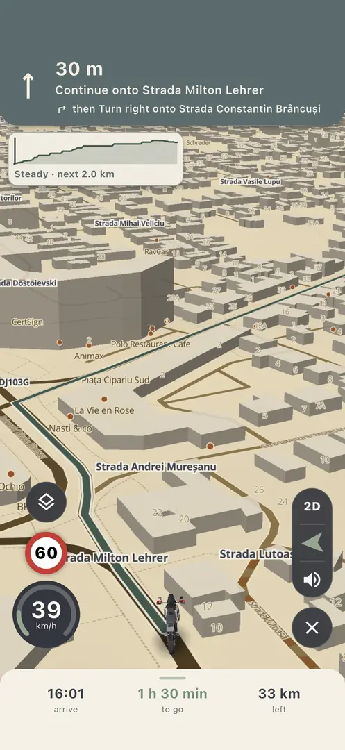
Motorcycle route planner

A motorcycle route planner for Romania and Europe

Ride Beyond is a free iPhone app that plans motorcycle routes the way you want to ride them: twisty paved backroads, off-road gravel and forest tracks, or simply the fastest way. It navigates them turn by turn, offline if you need, across 35 countries of mainland Europe. It was built in Romania, by a rider, on Romanian roads first.

Download on theApp Store

Free, for iPhone. Plan in a browser at /app.

Moto mode

How does it find curvy roads?

Pick Moto and the planner looks for twisty, hilly, paved backroads instead of the main road. A slider runs from Efficient to Scenic: Efficient is close to the car route, Scenic trades time for corners and climbs.

  • Moto stays on asphalt. The only gravel it accepts is the last stretch to a pin that itself sits on gravel, and the route panel tells you how long that stretch is.
  • Motorways are switched off by default and can be switched on per leg.
  • A scenic route is kept only while it stays reasonable: at full Scenic it may be at most about 1.9 times the distance of the Efficient route, otherwise the planner eases the slider back.
  • Before you ride, you see the surface split: how much asphalt, gravel, path and unknown surface the route has.
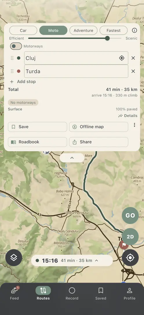
The planner with the Car, Moto, Adventure and Fastest chips and the Efficient to Scenic slider, on a route from Cluj to Turda

Adventure mode

Can it plan off-road motorcycle routes?

Yes. Adventure mode routes over gravel roads, forest tracks and paths, at the speeds an adventure bike actually rides them. A slider runs from Rally to Enduro:

  • Rally prefers fast, wide gravel and graded tracks.
  • Enduro goes looking for technical tracks and paths.
  • A Singletrack switch keeps narrow paths in or out, and dry or wet ground changes what it picks.

Routes follow OpenStreetMap access data: ways marked as closed to bikes or as military ground are left out. The map can be wrong, so the signs on the ground and local law always decide where you may ride.

There are also Car and Fastest modes, and every leg of a route can use its own mode.

For You

I have two hours. Where should I ride?

Tell the app how much time you have and it answers with loops that fit, on road or off road, starting from where you are. You can also plan around a place you want to see. Save a loop you like, or tell it why one is not for you, and the next suggestions take that into account.

Rides

Recording rides, and Garmin

One tap records a ride, with the phone on the bar or in a pocket. Recording works without signal, syncs later and survives a crash or a restart. Every ride shows a speed-coloured track, lean angle left and right, cornering, elevation, heart-rate zones and the surface mix.

If you ride with a Garmin, connect it once under Profile, Garmin: the app signs in to Garmin Connect from your phone and your motorcycle rides come in on their own. Ride Beyond is not affiliated with Garmin. Any ride exports as GPX, TCX or FIT.

An on-road and off-road rider rating is built from grip physics and your tyres, not from likes, and you can compare it with friends.

Friends

Riding with friends

See which friends are riding right now and where they were last seen, and share rides with photos in a friends-only feed. Privacy zones hide the places you choose, and one switch stops sharing your location.

Group rides come in the next version: friends who meet up ride one route together, start with one GO, and see each other on the way.

Rally roadbooks

Roadbooks from a recon drive

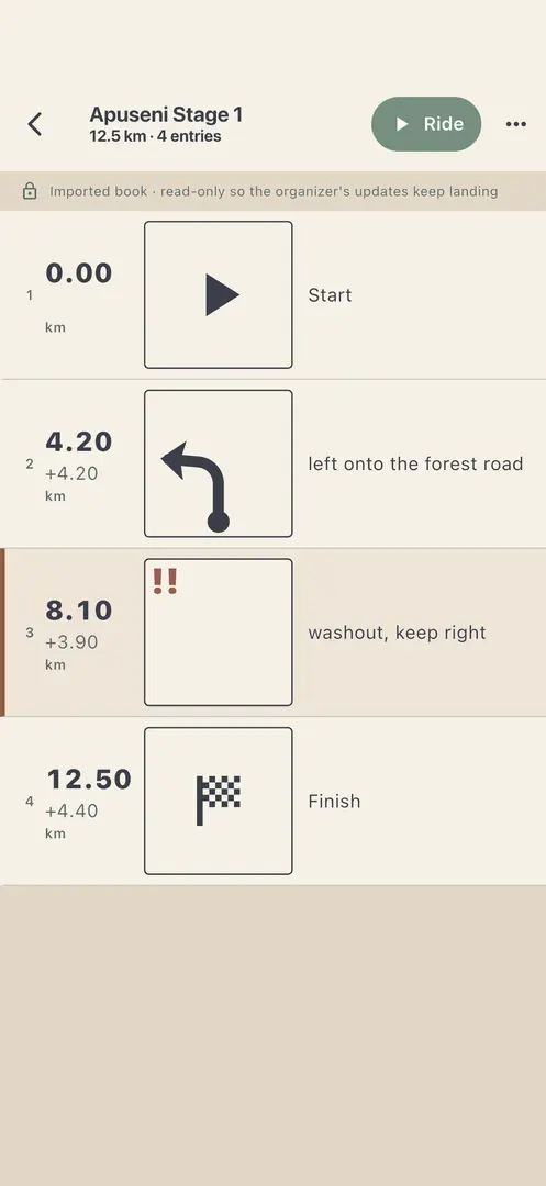
Drive a recon and the roadbook builds itself on the phone, offline: tulips, distances, CAP headings and dangers. Edit every entry, export it as OpenRally GPX, plain GPX, a printable PDF or JSON, or ride it on the phone with a trip odometer and live CAP.

A roadbook with tulip diagrams, distances and a danger entry

Conditions and terrain

Rain, mud, trails and protected areas

  • Rain radar and a ground-wetness layer that estimates how muddy the tracks are today.
  • A 3D map with terrain, forests and buildings, to see the climb and the valley before you ride it.
  • A Dark map for night riding and glare.

In the next version, now in testing: a Motorcycle trails layer (marked trails and motocross and enduro parks), a Protected areas layer with a notice when a pin sits in one, and off-road routes that keep out of strictly protected areas and off dedicated bike trails.

Coverage

Where does it route?

The map covers the world. Route planning, place search and navigation cover 35 countries of mainland Europe, from Portugal and Spain to Estonia and Greece: Romania and its neighbours, the Balkans, the Alps, Italy, France, Germany, Poland and the Baltic states. The full list is in the FAQ.

The routing was tuned on Romanian roads first, such as Cluj to Brașov, Sibiu to Curtea de Argeș and Hațeg to Lupeni, and those routes are checked again before every routing change ships.

Ride Beyond is free, has no ads and no trackers, and stores your data in the EU. See how it compares with other motorcycle apps on the comparison page.

Plan your next ride

Free on iPhone. No ads.